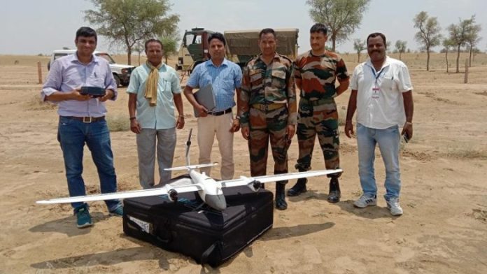
On Sunday, the defence ministry said that it had surveyed nearly 18 lakh acres of land. They have surveyed 18 lakh acres of Defence land. The land is fully scattered across 4900 pockets around India. The survey was actually taken for effective land use and planning, and it’s also done to prevent encroachments. This survey is also known as one of India’s most extensive such surveys.
The defence ministry said that the survey has been first-time using advanced technology. The survey involved the usage of satellite and drone imagery. With the help of advanced technology, the survey was fully completed in three years. The land surveyed included 1.61 lakh acres in 62 notified cantonments. And about 16.38 lakh acres of land, located outside cantonments and military stations.
The ministry said that the survey of the land is necessary for the protection of the defence land. And the situation of the boundaries is required for the same. This will help to safeguard the title of the defence ministry.
“Clear demarcation and boundary survey of defence lands and fixing of the boundaries is necessary for protection of the defence land, safeguarding of the title of the defence ministry, updating land records and maps, and prevention of encroachments,” the ministry said in a statement. The largest survey was then kicked off in 2018, in October.
There are 16.38 lakh acres of land outside cantonments. Out of that, a total of 18,000 acres of land is state-owned. Or the land is also proposed for deletion from defence records, and this is because they may get transferred to other government departments.
Modern survey technologies such as Electronic Total Station (ETS) were also used. In addition to this, the Differential Global Positioning System (DGPS) was also used in the survey. This made to survey easier.
“For the first time, drone imagery-based survey technology was used…Besides this, satellite imagery-based survey was done for the first time for many defence land pockets,” it said. They used 3D modelling techniques for better visualisation of defence land in hills. These 3D modelling techniques were also introduced by using a digital elevation model (DEM).
The digital elevation model (DEM) was then created in association with Bhabha Atomic Research Centre (BARC).
The use of high-tech and advanced technologies ensured faster completion of the survey. The entire area was also surveyed with the help of the Surveyor General of India in a matter of weeks. This is such a big survey that earlier, it used to take years for completion.
A project for a real-time change detection system for the detection of encroachments on defence land has also been initiated as a part of the project. The real-time change detection system is now based on the Time series Satellite imagery. Pilot tests have also been carried out on satellite imageries of defence land pockets. This has been now procured from National Remote Sensing Centre in Hyderabad.
Geo-referenced and digitised shapefiles are also made available. This is basically done to enable quick decisions made by officials of DGDE & MoD.
The Association of Revenue officials in the survey will help to reduce boundary disputes. It usually happens between stakeholders. This would also help to resolve legal conflicts at many levels.
The largest survey is now completed because of the Capacity Building of technical personnel. This was also made possible by the officers of the Defence Estates Organisation in the latest technologies for Land survey. This has happened over the years in association with premier institutes. Those includes:
National Remote Sensing Centre and National Institute for Geo-Informatics Science and Technology.
A Centre of Excellence (CoE) on Land Survey and GIS mapping has also been now established in NIDEM (National Institute of Defence Estates Management). This has now been done for capacity building of Defence Estates officials in the field of modern survey technologies. The CoE aims to be an apex survey institution. They want to be capable of imparting training of various levels to the officers of Central & State Govt. Depts.


